Blog Archives
Tropical Tangerine Trouble (Train?)
It seems like every year there are periods where the tropical on and off switch change from on to off and off to on with little to no explanation. Today, that switch was lifted to the “on” position, and it seems that it may stay there for a week or more. Generally explanations for elevated tropical activity come from the Madden Jullian Oscillation (the “on” switch that travels the globe every 40 days), an active African Wave Train, or even a frontal boundary across the Gulf of Mexico. All three of these measures are in the off or standby positions. Yet, on the 9th anniversary of Hurricane Charley’s landfall, we have two areas of thunderstorms that were simultaneously designated as tropical areas of “invest”igation by the National Hurricane Center this afternoon.
Invest 92L, a large disturbance in the western Caribbean remains rather disorganized, but has large model support. The tropical and barotropic models are just beginning to run, but when combined with the global models become a conglomeration of unclear future avenues for this disturbance. Each one shows a system slowly growing into a weak tropical cyclone in the Gulf of Mexico nearing the weekend, but the models vary from the Okaloosa beaches of the western Florida panhandle to areas north of Tampico, Mexico. Even with the mystery future in the models, the result for most of the gulf coast seems to be the same: a wetter weekend.
Let’s back up just a bit with this nighttime satellite image:
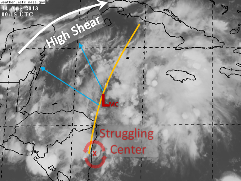
As you would expect with a weak tropical system, this one has multiple centers at multiple levels in the atmosphere. The two main centers are a struggling low level center at the tail end of the tropical wave and a seemingly stronger center in the mid levels off the NE coast of Honduras. The main area of spin is a very broad area from the Cayman Islands down to Nicaragua. No matter which model you look at, this disorganized mess moves to the WNW or NW toward the Yucatan Peninsula. If for whatever reason the center currently moving ashore in Nicaragua survives the trek across that country and mountainous Honduras, that would set this system for a very energy starved trek toward the Bay of Campeche. The second more likely scenario is one toward the tip of the Yucatan that would bring it into the Gulf of Mexico in a couple of days.
In either case, I do not think this will be able to intensify very quickly. The surrounding land masses will not make it easy for this large system to supply energy to itself until it makes it into either the Bay of Campeche or the Gulf of Mexico. Two areas of shear are forecast by the models: one from the Yucatan to the Florida Straights and another in the northern Gulf. The first is expected to move northward with the system, and a building anticyclone should assist with that and the safe harboring of the system somewhat. The second is a equatorward drifting cold front that may down the line set up for a northeastward moving system over the weekend near the northern Gulf. I do not believe this shear is being handled well at this time, but with newer nested models currently running we’ll have a better picture tomorrow.
Another small battle this system will have will be a batch of dry air that is moving from the Bahamas toward the west. This dry air is not nearly as dry as the air Dorian dealt with, however it still may hinder this system on the outer edges.
RAINFALL: Combined with that cold front and some shear, this system will be increasing rain chances from Texas to Florida as we head into the weekend. The best rain (and flooding) chances will likely be between eastern Louisiana to southeastern Georgia, and then up toward the Appalachians and coastal Carolinas, as seen here in the forecast from the Weather Prediction Center:

Obviously, if this system takes course number one toward the west, some of this rain will fall farther to the west. With a westward going system, that system will likely be weaker due to more land interaction. That would most likely still place most of its rainfall to the east of the system. Get out your boots and umbrellas for your weekend plans at gulf coast. I would recommend watching the weekend forecast if you do want to head out by boat or beach this weekend.
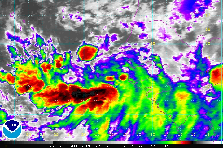
Invest 93L is creating quite a bit of thunderstorm activity from the coast of Africa to the Cape Verde islands. The models on this system are just as widely varied as they are with 92L, although we have a lot more time to look at it. The general idea is that this large system will move toward the west or west-northwest into the Atlantic over the next week and then out to sea, but while intensifying. This currently seems like a repeat of Dorian, with a moderate tropical storm in the central Atlantic over the weekend. The longer term models have 93L faltering toward the middle of next week before reaching the leeward islands. Take note in the satellite image below that there is more thunderstorm activity to the east. This is typical of this time of year, and the models do show another system in a week or so. We are now a month away from the peak of hurricane season.
Bottom Line: In the next week we may cross two storm names off the list. One in the Gulf, and another in the mid-Atlantic. If you are in the northwestern Caribbean or elsewhere along the Gulf of Mexico Rim, you’ll want to watch for and prepare for a tropical system late this week and into the weekend. Be in a cautious and alert mode, but do not worry about these systems.


You must be logged in to post a comment.