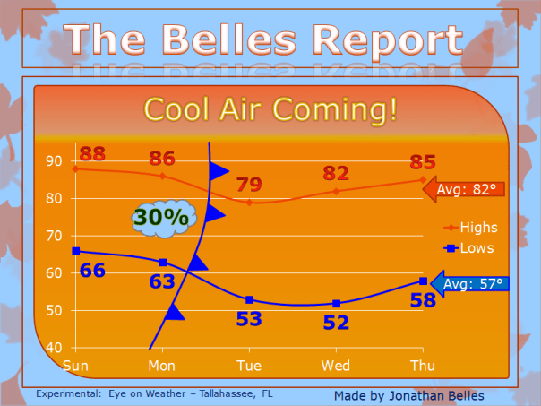
Cool Air Coming!
After a warm weekend, another cold is heading into the southeast this week! That means cooler and drier air is on the way for the better part of the work week. Temperatures will run just below normal during the middle of the week. Unfortunately, rain chances will be slim as the front moves through. The best rain chances will exist to the north and west before frontal passage, which will occur Monday morning in the western Florida panhandle, Monday afternoon in the eastern panhandle , and overnight Tuesday into Tuesday morning for the southern two-thirds of Florida. Rain chances drop off south of I-10 east of Live Oak to below 20%.
Below is a look at the week ahead for Tallahassee! Enjoy!
Posted on Sunday, October 14th, 2012, in Florida Weather. Bookmark the permalink. Leave a comment.


Leave a comment
Comments 0