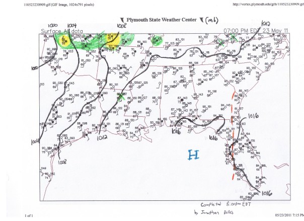
Surface map of the southeastern US. The afternoon sea breeze is seen pushing east across FL and away from the coast in GA. Mountains of high pressure are seen in the northern Gulf of Mexico and in the Atlantic (not pictured). Strong low pressure area is just moving into the picture in Oklahoma. Green X's signify points that I removed from my analysis.
Although the very stubborn high pressure area will begin to crack down and allow moisture to finally move in across FL and the rest of the southeastern US, the very strong area of low pressure across the central and northern plains will have no effect precipitation wise in the SE. Moisture will be funneling in from the Caribbean and an upper level trough coming in from the SW. Temps will be remaining very warm for the next day or two until this moisture moves in on Friday.

Leave a comment
Comments 0