Stormy Night
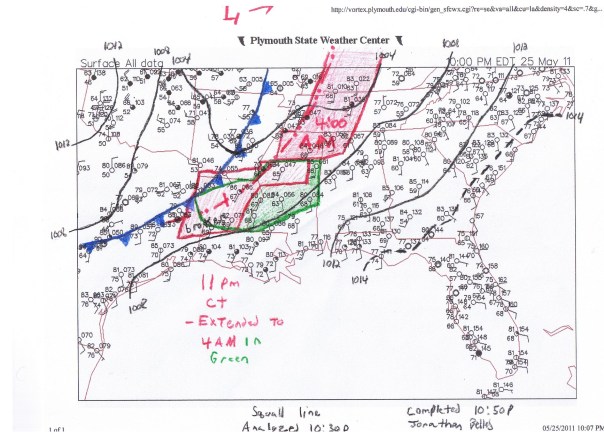
Very messy night across the upper southeast tonight. A very strong cold front is charging ahead of the Low centered in Missouri, and a very intense squall line is charging even further ahead. Thus far (as of 11:00pm ET), more than 70 reports of tornadoes have been reported to the Storm Prediction Center, which was evacuated in Norman yesterday due to the system. Reports of severe weather, tornadoes included, range from southern Texas to western New York hitting cities and rural areas alike. New warnings and watches are popping up every few minutes as the squall line pushes east.
The entire line should weaken overnight, but it will not dissipate. Severe weather will continue tomorrow from New York to Alabama. As the line gets closer to the Sunshine State, it will provide just enough moisture to create some popcorn storms in the Panhandle. Some moisture to our south will also provide some storms in Southern Florida. I don’t expect more than the normal pop-up variety storms across the area for now, but my thinking is beginning to lean toward a more linear threat moving into NW Florida. We’ll take a wait and see plan for now.
As you go out across the state, you will feel more humidity throughout the weekend. All of this should clear by early next week. Stay tuned for your Memorial Day Forecast.
Posted on Wednesday, May 25th, 2011, in Severe Weather. Bookmark the permalink. Leave a comment.


Leave a comment
Comments 0