Storm Chase Report Part 1
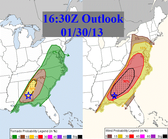
With all signs pointing to an active non-supercellular kind of severe weather day, three of my FSU meteorology classmates and I decided to hit the road yesterday morning for SE Alabama. Our original target area was Dothan, AL, which had a slight risk of severe weather and an increased risk of high winds. Although our sights were on wind, the Storm Prediction Center had also included an increased risk of tornadoes (10%H) just to our target location. Below is what we were going into:
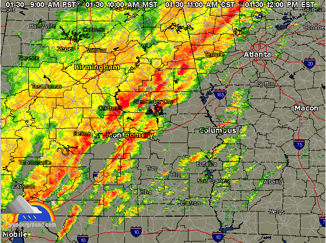
So, we set out toward Dothan from Tallahassee. We knew that ample lift was going to bring about smaller, disorganized cells that were only going to provide a pain for driving through. Here is the radar from 11am CT:
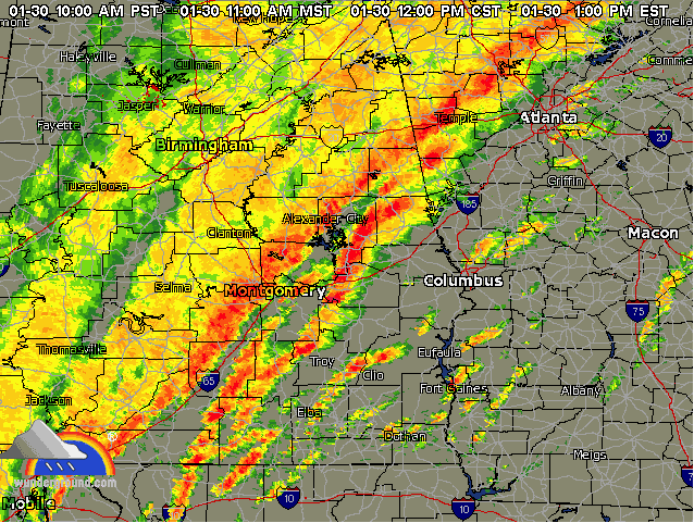
When we reached Dothan, we were still surrounded in the not-so good looking storms with shallow extent. We decided to head up to Ozark, where we finally saw our first good cell. The sun was breaking out, and finally we could see some vertical extent to the clouds. You can see that cell near Clio below. We watched the first cell go by in Ozark and tracked the second cell to between Clio and Abbeville. Funny enough, ended up watching the second storm blow by with some mild winds (20-30 mph) and great inflow aloft in a field and watermelon patch that Rosa Parks used to live on.
From there, we ping ponged a few unimpressive storms before deciding to head SSE toward the triple point where AL, GA, and FL meet. We settled into an open field south of the Chattahoochee State Park on the Florida side and waited for the solid squall line to roll through. Here is a picture taken by Lauren Visin using radar scope just before the squall line hit:
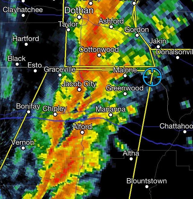
This line segment caused winds sustained at 50-55 mph with gusts to 60 mph, horizontal rain, and many tree branches to be downed including one large tree near Greenwood. All the while, there was absolutely no lightning and no hail. Just plain wind and water.
We did not hit any flooding until we reached Tallahassee and exit 196 getting off of I-10 as we were attempting to re-punch the squall line. Flooding there was minor with only one lane being partially covered in standing water.
Below is the location of our punch (#1) location and the damage.

I’ll post the pictures from our trip later today or tomorrow here, or you can watch for them tonight on FSU Weather at http://www.livestream.com/fsuweather. If you are lucky enough to live in Tallahassee, you can watch on channel 4 as well. Either way, you can watch us at 6pm or 11pm Eastern Time. See you there!
Thank you to Lauren Visin for driving through the extremely treacherous weather, and to Matt Brady for Radar Guidance and Paul Flanagan for Navigation.
Share this!

Posted on Thursday, January 31st, 2013, in Severe Weather. Bookmark the permalink. Leave a comment.

Leave a comment
Comments 0