Hawaiian 1-2 Punch Begins Tonight
Good afternoon!
There are just a few hours left before Iselle’s impacts truly reach the Big Island, so I decided to do an early post today. Although Iselle is still technically a hurricane, winds at least at the surface are beginning to fall below hurricane strength. This is a great time to remind everyone that winds often are higher above the surface whether it is a volcano, mountain, or in downtown high rises. Winds can often be 1-3 categories higher just a few thousand feet up. The same thing may occur on the highest peaks of Hawaii Islands tonight. Peaks there overshoot 13,000 feet. From sea floor to mountain peak, some of these mountains are taller than Mount Everest.

Impacts tonight on Hawaii Island are as follows:
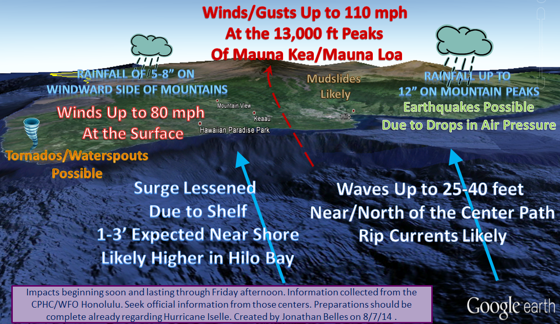
It is important to emphasize two potential danger parts of the islands. We often say run from the water and hide from the wind. This case there will be an in between point that will be the safest. The city of Hilo sits in a bay on the northern coast. With winds blowing from the northeast toward the southwest, there will be a period in which water and waves will be funneled into Hilo Bay. It will not be save to be on the coast especially in that bay. On tops of the windward facing mountains/volcanoes, rainfall totals could get up to 12″ and winds could gust to 110 mph. It is important to note that the most heavily populated areas will see lesser impacts with the exception of very high waves. That is going to loosen up some soil, and I think that mudslides and lahars are possible.
Meteorologically speaking, recon planes are flying through Iselle at this hour. Winds at the surface are likely around 70 mph and winds above the surface are around 75 mph at 10,000 ft. Due to the terrain involved in the forecast we have to look at those winds at 10,000ft as surface winds on the mountains. Iselle is a disorganized system based on satellite pictures, and the hurricane hunters have found an open eyewall on the southwestern side.
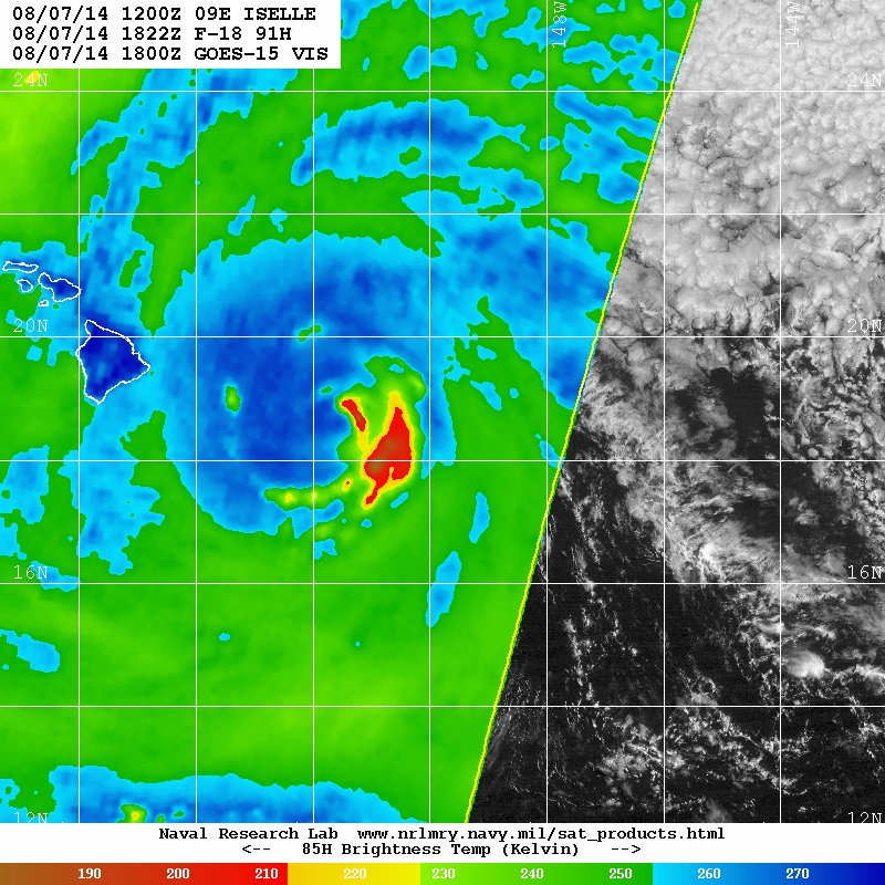
The above satellite image takes a look at the structure of Iselle above the surface. The blue areas are lower cloud decks, so don’t be fooled into thinking there is nothing there. You can see some of that on the right side of the image. The eyewall remains strong. No intensification is expected before landfall, however funneling in between mountain peaks and frictional convergence is a possibility as this system gets closer to the islands.
I’ll take a look at the rest of the islands later tonight as well as a look at Julio. My post tonight will likely be later than the normal post time as of late.
I’ll be tweeting about this (and likely Big Brother :P) through the evening @JonathanBelles
–JonathanBelles
Share this!

Posted on Thursday, August 7th, 2014, in Tropical Weather. Bookmark the permalink. Leave a comment.

Leave a comment
Comments 0