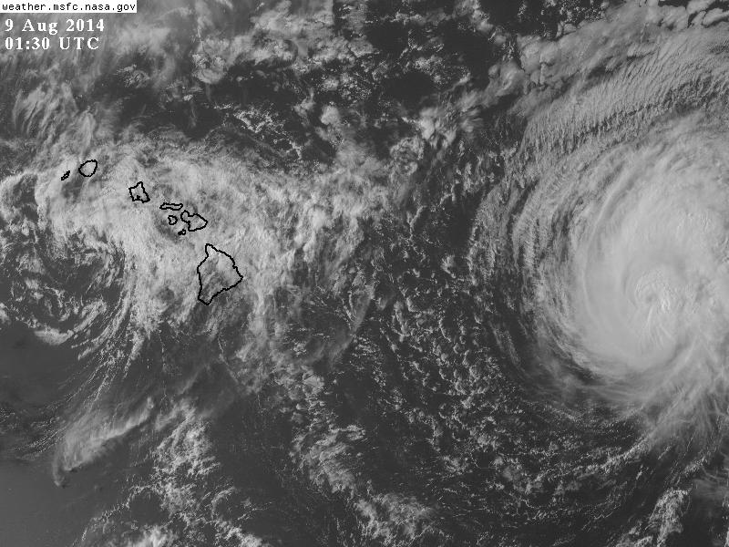
Iselle Moves Past the Big Islands, Interacts with Volcanoes
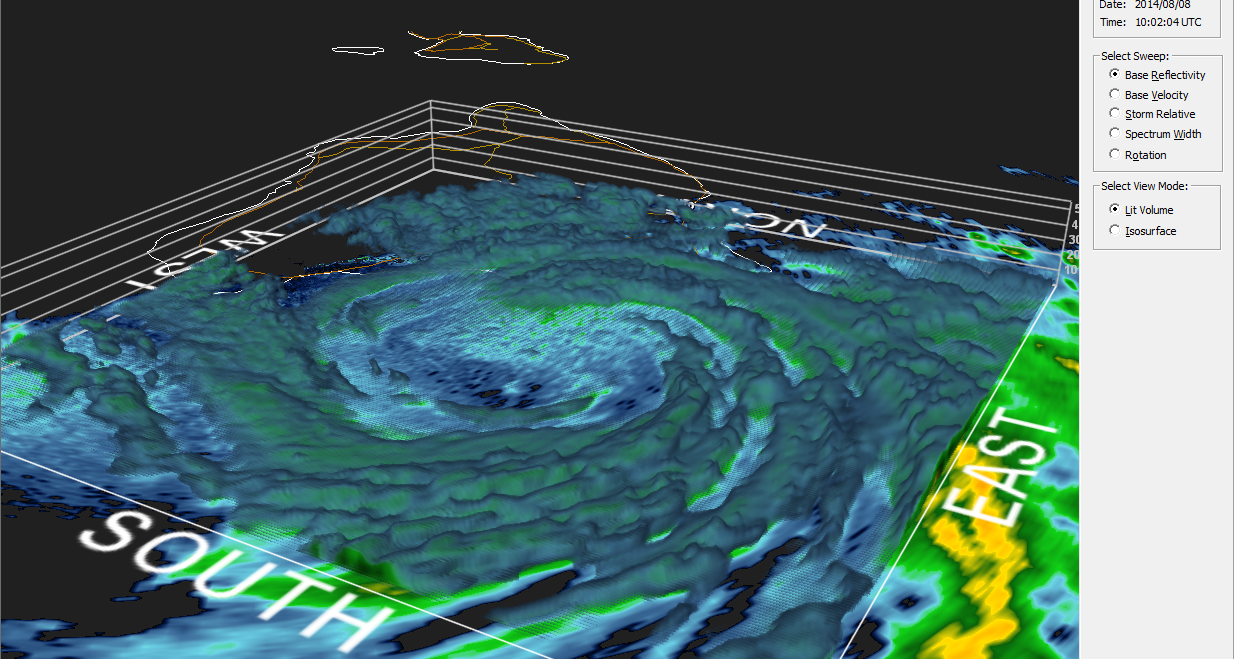
Last night was a long night for both the residents in the eastern Hawaiian Islands and the forecasters and observers of Iselle. It became quickly apparent that Iselle was slowing down on approach to the eastern shores of the big island. Iselle made landfall numerous hours after the anticipated landfall time, which racked up both the rainfall totals and the damage. As satellite images began to worsen in appearance the radar imagery got just a bit better organized.
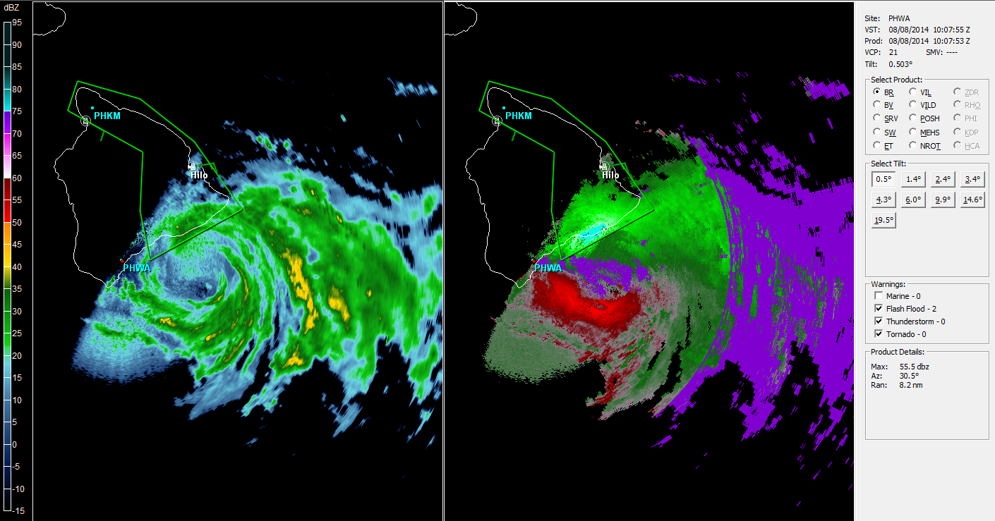
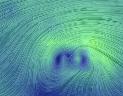
You would expect winds to increase, but instead they became very disorganized. As Iselle slowed down to around 10 mph in forward speed, winds were also being funneled through the channels of the islands namely the Alenuihaha or Maui channel. This created a great study topic as a second vorticity maximum developed at the lower levels to the west of the Big Island. There is some dispute where or not this system had two strong LLCs or not. This is likely due to the 14,000 ft peaks on the Big Island that act to redirect winds around that island. In fact, Kona and Honolulu has temperatures rise and clouds suppressed as winds came down the mountains on the leeward side.
Winds at the surface seemed to show a landfall before midnight, but radar (scanning the lower levels) showed a more realistic landfall for most residents. Radar fell apart after that time and continues to be disorganized. Most of the rainfall this evening is to the south of the central islands.
Selected Rainfall Totals As of This Morning:
- Kulani – 14.51″
- Glenwood: 13.89″
- Pali – 10.68″
- Puu Kukui – 5.36″
- South Point – 4.33″
- Pahala – 3.82″
- Hilo – 3.61″
- Mauna Loa Observing Station: 2.14″
Selected Maximum Wind Gusts as of This Morning:
- Mauna Kea – 91 mph
- Oahu Forest – 72 mph
- Kula – 61 mph
- Malokai – 57 mph
- Hilo Harbor – 56 mph
- Kona Int’l – 45 mph
- Honolulu – 41 mph
- South Point – 33 mph
Current Information From the CPHC (as of 2pm HST):
- Winds: 40 mph
- Present movement: West at 18 MPH – acceleration since last night before landfall
- Minimum central pressure: 1010 mb
- Tropical Storm Warning: Maui County, Oahu, and Kauai County…winds of 40 mph or greater are EXPECTED!
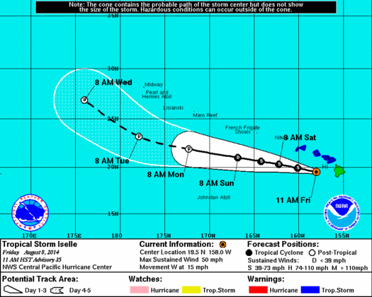
Impact and Discussion: As you can see from the official track of Iselle, the remainder of its lifetime will be spent south of the Hawaiian Islands and atolls. Moderate rain and gusty winds will be ending from east to west as Iselle pulls away tonight into tomorrow before Julio moves in. As of right now, Julio is expected to follow a parallel path to Iselle, but well to the north of the island chain as it gets steered toward the west-northwest by the pacific subtropical high. This should limit most of the impacts to the islands although gusty conditions are still possible. No watches or warnings are in effect for Julio, but warnings do continue for Iselle. Boating traffic around the state will need to be keen to conditions through at least Monday or Tuesday until Julio departs the region. Julio is currently a category 2 hurricane with winds of 100 mph, but is expected to weaken as it approaches the island’s longitude. Recon is approaching Julio to determine the accuracy of current conditions and to collect the information for the models. The current models are in agreement with the current track from the CPHC.
Pictures of Iselle, Julio, and their impacts are always welcome @JonathanBelles
Mahalo for reading!
–Jonathan
Share this!

Posted on Friday, August 8th, 2014, in Tropical Weather. Bookmark the permalink. 1 Comment.

Reblogged this on the WeatherAction Blog.
LikeLike