Daily Archives: Tuesday, May 22nd, 2012
Tropics do not want to sleep, 94L forms
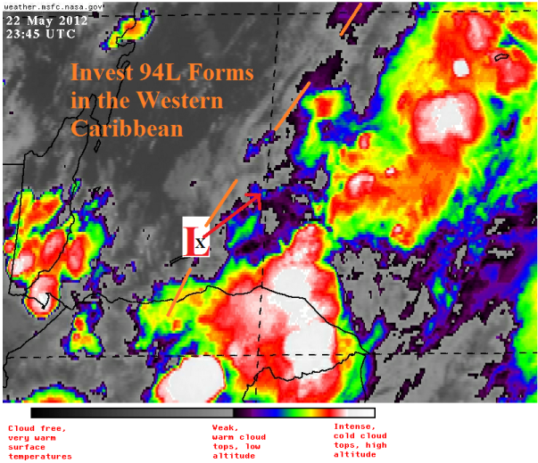
The tropics just do not seem to want to give up the ghost. Yesterday I reported that Alberto had been killed by an increase in shear and a decrease in water temperature and if you look at satellite today you will not even find a swirl left to show here….however, the tropics aren’t done. Our friend down in the Caribbean has become slightly better organized and shear has relaxed a bit, enough for the NHC to designate it Invest 94L. The area shown on satellite below is a still disorganized area of low pressure that is expected to move northeastward. It has a pressure of 1008 millibars with winds mainly off to the eastern side up to 30 mph. 94L is almost completely linear in nature with a broad surface low on the end of a surface trough. Shear over the area is currently only marginally favorable over 94L and is very hostile in the forecast path of 94L. Tropical cyclone formation in the Caribbean over the next few days is dismal.
Just peering over the recent model runs, and the overall consensus is that 94L will drift to the NE ahead of a longwave trough that deamplifies by Wednesday, and a batch of energy (a shortwave trough) at the mid levels of the atmosphere moves over the Gulf of Mexico helping pull 94L northeastward. Where it becomes funky is over the holiday weekend, high pressure builds in over the central Atlantic and slows 94L down and possibly moves it westward toward Florida. This is just one possibility, and I expect this to be no more than just an area of heavy rain…but this could be possibly flooding rain in south Florida.
Flooding outlooks continue to be bad for south Florida. Along the Alligator Alley corridor, some locations have picked up 3-4″ of rain over the last week, and in Miami they picked up nearly 10″ today alone! The 18z NAM has totals over 3″ for the metros of south Florida and the Florida Keys, and a couple of the other models show similar totals. Combined with local sea breeze effects, rain totals locally could be impressive and possibly oppressive . I will continue to watch this aspect of 94L the most. Of course, much of north and central Florida would find this rainfall very welcome since there a moderate drought is in place and has been since the beginning of the year.
Over the next couple of days I will be taking a look back at Alberto, as well as continuing to watch 94L.


You must be logged in to post a comment.